Anwick Airfield History

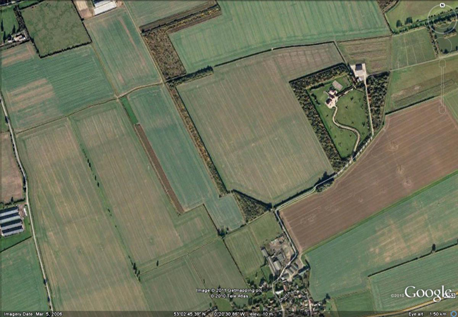
(Map edited to show runways)

© Crown Copyright/MOD 2010
53°02'43.66”N 0°20'40.98” WRunways:
Not known
Anwick was an active airfield during the Great War only, from 1916. It acted as an emergency landing strip for the Home Defence Squadrons which were tackling the Zeppelin threat on the approaches to the Midlands. The airfield was centered NNW of Anwick village church. A telegraph wire was run from Ruskington village to the airfield. No.38 Squadron, based at RFC Melton Mowbray, was responsible for Anwick between September 1916 and May 1918.
The landing ground did not support any permanent buildings but covered an area of 54 acres. Night lighting was provided by petrol-soaked rags in cans, categorised as basic lighting. Squadrons based at Anwick airfield received pilots and navigators who had been trained by No.33 Squadron. During World War II Anwick acted as a decoy airfield from 1939 for RAF Digby but closed in 1942, reverting to farmland. During decoy operations, eight airmen worked shifts from a cramped dugout with an electric generator to light the flight path. The decoy site was abandoned by August 1942.
Anwick lives on in the Old Manor Farm strip at Anwick Garden Centre. There is a single grass strip and one hangar.
| Date | Squadron | Notes |
|---|---|---|
| September 1916 | Station opened. | |
| September 1916 | No.38 Sqn RFC | Operating the Royal Aircraft Factory FE.2 and BE.2. Left Anwick in May 1918. |
| June 1919 | Station closed. | |
| 1939 | Station re-opened as a decoy airfield for RAF Digby. | |
| August 1942 | RAF Anwick closed. |
